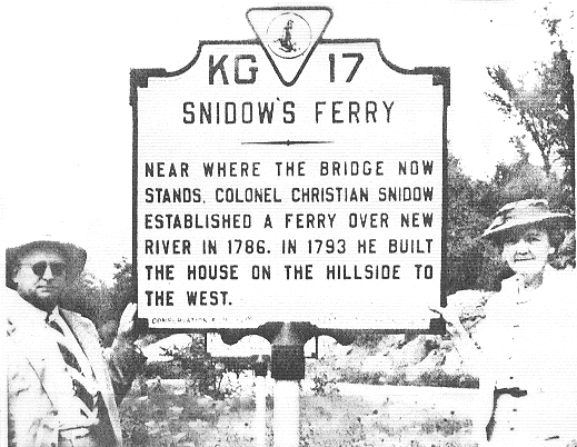
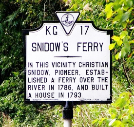
The original Snidow's Ferry historical marker - pictured below - was erected in or before 1941 by the Virginia Conservation & Development Commission (not 1947 as was previously stated here). Location: 37 degrees 19.785' N, 80 degrees 40.499' W. The current marker - pictured to the right - is between Pembroke and Ripplemead, Virginia in Giles County on Route 460 approximately 1/2 mile west of Big Stony Creek Road (VA RT. 635), on the right on the west-bound side of the road. This marker was erected sometime prior to 1980. The original marker was on the other side of the road a little further west near New River. (picture below)
According to family records, the Ferry was established in 1785. A Montgomery County order of Feb. 28, 1786: "Ferry granted to Christian Snidow about a mile below the mouth of Walker's Creek across New River." Again, in Giles County May court 1818, Isaac Chapman and Christian Snidow were granted a "motion to establish a ferry over New River on the road from Giles Court House to Montgomery Court House on lands of Chapman and Snidow". Pictured here by the original historical marker is John Jacob Snidow Sr. and his wife Lucille Williams Snidow in 1941. John died the following year in 1942 (see our Old Obits page). This picture appeared in the Autumn 1995 Snidow Newsletter.
Also see our page about the old Pembroke ferry (Snidow's Ferry at Castle Rock) here.
 The original Snidow's Ferry historical marker - pictured below - was erected in or before 1941 by the Virginia Conservation & Development Commission (not 1947 as was previously stated here).