Giles County, Virginia Info
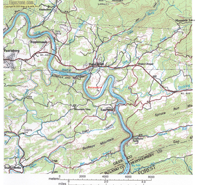
It is 358 square miles in area. New River runs 37 Miles through it and there are 34 Named Summits.
Origin of Giles County:
- 1721 Spotsylvania Co. formed from Essex, King & Queen, and King William Counties.
- 1734 Orange Co. formed from Spotsylvania Co.
- 1745 Augusta Co. formed from Orange Co.
- 1770 Botetourt Co. formed from Augusta Co.
- 1772 Fincastle Co. formed from Botetourt Co.
- 1777 Montgomery Co. formed from Fincastle Co.
- 1806 Giles formed from parts of Montgomery, Tazewell and Monroe (now WV)
counties.
The major changes to Giles County borders (Source: VaGenWeb):
- 1808 Giles gained part of Wythe Co.
- 1824 Logan Co. formed from parts of Giles, Cabell, Tazewell & Kanawha Counties.
- 1837 Mercer Co. formed from parts of Giles & Tazewell Counties.
- 1851 Craig Co. formed from parts of Giles, Botetourt, Roanoke & Monroe Counties.
- 1861 Bland Co. formed from parts of Giles, Wythe & Tazewell Counties.
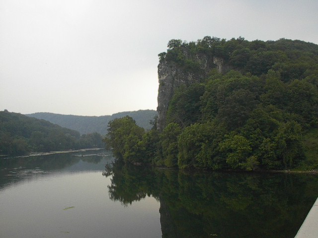
Castle Rock on New River in Pembroke, Virginia. (August 11, 2002)

|
|
|